DJI Mini 5 Pro waypoint missions
Draw your mission on a large map, let SmartWaypoints place the waypoints, then fly it with DJI Fly on your Mini 5 Pro. No more tapping points one by one on the controller screen.
DJI Fly lets the Mini 5 Pro follow waypoint missions, but building one on the remote is slow: every point, height and camera action is set by hand on a small screen. SmartWaypoints does that work on a computer. You describe the result you want — an area to cover, a building to orbit, a line to film — and the waypoints are calculated for you.
How to create a DJI Mini 5 Pro waypoint mission
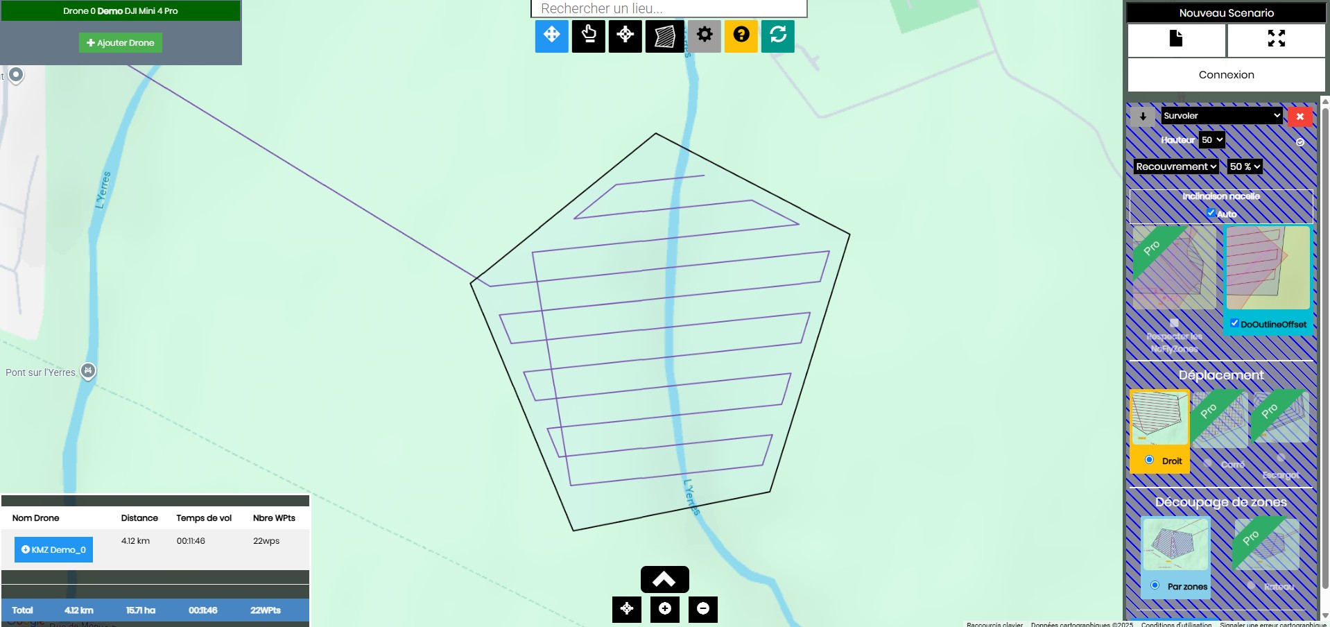
- Find your site. Search an address or move the map to the area you want to fly.
- Draw what you need. A polygon for an area (overflight, photo grid, video sweep or no-go zone) or points for single shots, POI orbits, take-off, start/stop video.
- Set the mission. Height, overlap or fixed line spacing, speed, gimbal angle, heading, movement pattern.
- Generate the waypoints. SmartWaypoints shows the path, its length, flight time and number of waypoints for each drone.
- Download the KMZ and load it into DJI Fly (step-by-step guide).
What you can do with it
- Points of interest: a POI photo or POI video point with a radius produces a clean orbit around a house, a monument or a landmark.
- Repeatable shots: save the scenario and fly exactly the same path next week, next season or after construction progress.
- Photo grids: cover a field, a roof or a garden with an overlap you choose, then stitch the photos in your photogrammetry software.
- Camera control: gimbal angle and heading per photo point, start and stop video on the path.
- Avoid areas: draw a no-go polygon and the path goes around it.
Coverage patterns
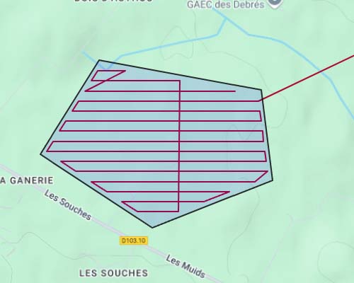
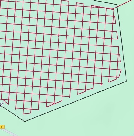
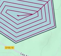
For an area, choose how the drone sweeps it. Line spacing comes either from the photo overlap you ask for or from a fixed width.
Plans
You can start without an account. The free plan covers simple missions; the paid plans raise the waypoint limit and unlock the advanced options.
| Basic — free | Pro — 9 €/month | Premium — 25 €/month | |
|---|---|---|---|
| Waypoints per mission | 40 | 200 | 10,000 |
| Scanning patterns | Straight lines | All (straight, squared, snail) | All |
| Photo at every step | — | Yes | Yes |
| French no-fly zones | — | Yes | Yes |
| Split by drone autonomy | — | Yes | Yes |
| Terrain-following heights | — | — | Yes |
Frequently asked questions
Does the DJI Mini 5 Pro support waypoints?
Yes. The Mini 5 Pro has the waypoint feature in DJI Fly, and DJI Fly can open a waypoint mission saved as a KMZ file. SmartWaypoints creates that file.
How do I load the mission on my Mini 5 Pro?
Download the KMZ from SmartWaypoints, then replace a placeholder mission in the DJI Fly waypoint folder. The KMZ import guide shows each step.
Do I need to install anything?
No. SmartWaypoints runs in a web browser on a computer or tablet. You only use DJI Fly on the controller or phone to fly the mission.
Is it free?
Yes, the Basic plan is free and allows missions of up to 40 waypoints with straight scanning lines. Pro (9 €/month) and Premium (25 €/month) add more waypoints and advanced options.